TopoMapViewer
The TopoMapViewer is a free, responsive web application to view standard topographic maps of the NGI.

The EFGS, organised jointly by Statbel and the NGI in Brussels, offered numerous European experts from the statistical and geographical sectors the opportunity to participate in three days of joint reflection, take stock of the current situation and explore joint solutions to the many challenges we face.
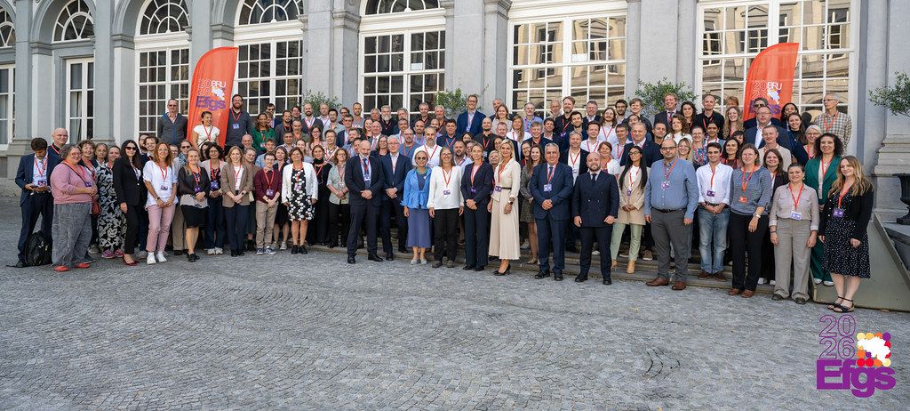
Whether it is climate change, inequality, urbanisation, public health or food security, all these challenges have a geographical dimension. By combining statistical and geospatial data, vulnerabilities can be brought to light, trends can be identified and policy decisions can be better substantiated.
This link is also gradually taking shape in Belgium. The growing collaboration between the NGI and Statbel brings together geographical and statistical data. This cross-fertilisation gives a clearer picture of territorial realities and our society, making information more relevant and useful to policymakers.
During the gala evening, Ingrid Vanden Berghe presented the Lars H. Backer Prize, an award for individuals who build on this connection and help the sector advance.
Earlier in the day, she had also delivered the opening address at the high-level session, alongside representatives from Statbel, Eurostat and EFGS, and took part in a fireside chat entitled ‘The way forward: the roadmap towards a geo-enabled future’. At this closing discussion, Ingrid Vanden Berghe, Marie Vandresse (Statbel), Jack Hamande (Director-General of the National Crisis Centre) and Luc Bas (Director of the Belgian Climate Risk Assessment Center) summarised the key insights from the day. They discussed shared challenges, new opportunities and priorities for further integrating statistical and geographical data. Our ambition for the coming years is clear: to use geographical and statistical information as a strategic lever to anticipate future developments more effectively, bolster our resilience and take more targeted action.
Integrating statistical and geographical data more effectively will help us better identify inequalities across regions, cities, neighbourhoods, or population groups that may remain hidden in aggregated statistics. The discussions also revealed that integrating data is not based solely on technology and technical progress. It requires vision, leadership, good governance and, above all, the ability to work together across institutional and geographical boundaries and beyond the confines of functional silos.
European priorities for geospatial information to serve the future
On 2 October, Johannes Van Geertsom, International Coordinator at the NGI, presented the new work plan and priorities of UN-GGIM: Europe up to 2030. This strategy reaffirms a key ambition: to strengthen European cooperation in order to capitalise on geospatial information in the interests of a safer and more sustainable world.
The strategy builds on existing work, in particular regarding the implementation of the UN-GGIM global frameworks and the Global Geodesy Supply Chain, while at the same time introducing new priorities.
One of these priorities, Data in Response to Global Agendas, places greater emphasis on geospatial and statistical data as a strategic lever in preparing future development agendas, both at global level, with the development agenda after 2030, and at regional level, by helping to define European priorities.
The pre-conference: an opportunity for sharing and exchanging expertise prior to the EFGS
The pre-conference took place on 30 September. Four experts from the NGI’s PM Broker Service took part in three sessions:
The wide range of presentations at the event illustrated the added value of geospatial statistics, their broad applications, and the opportunities to better leverage their potential.
Shaping the future of geospatial statistics must be a collective effort. Public sector organisations are therefore responsible for putting these frameworks into practice by strengthening cooperation, sharing expertise, investing in interoperability and gradually building data infrastructures that can meet the needs of the future. In this context, a forum such as the EFGS therefore plays a vital role, bringing people together to share experiences, engage in dialogue and jointly reflect on further integrating statistical and geographical data. As co-organiser of the 2026 edition, the NGI was proud to play its part.
Quid ex ea quid est cur nec me tamen laudandis maioribus meis corrupisti nec voluptas assumenda est, quid aut rerum necessitatibus saepe eveniet.
Oops! It looks like you're using an outdated browser. This can ensure that this website does not function properly. We strongly recommend that you pick up the latest version of your favorite browser . With a recent browser you can surf around safely and optimally.