
PRESS RELEASE: Explore 250 Years of History with a Single Click: NGI Launches Topoferrarisviewer
What did your district look like 250 years ago? How have the forests, villages, roads, and watercourses changed over time? To mark its 50th anniversary, the National Geographic Institute (NGI) is launching Topoferrarisviewer, a new free application that allows users to explore the history of Belgium’s landscape and discover how it has changed over time.
Brussels, 17 June 2026 – Press release.
Topoferrarisviewer offers the general public unique access to nearly two and a half centuries of change in the Belgian landscape. This project illustrates the NGI’s commitment to making its exceptional cartographic heritage accessible to the public and showcasing the expertise it has developed throughout its history.
The NGI would like to extend its sincere thanks to the Royal Library of Belgium (KBR) for its excellent cooperation and, in particular, for making the Ferraris maps in its collections available. This partnership contributes to the promotion and dissemination of an exceptional cartographic heritage to the widest possible audience.
Eight maps to explore 250 years of the territory’s evolution
With Topoferrarisviewer, you can compare and overlay eight map layers covering nearly 250 years of Belgian history. The oldest is the famous Cabinet Map of the Austrian Netherlands and the Prince-Bishopric of Liège from 1777, better known as the Ferraris map. The application also includes several generations of topographic maps produced by the NGI and its predecessors, up to the present day.
How does it work?
Topoferrarisviewer is a completely free application that can be accessed with a single click via this link https://topoferraris.ngi.be/ and is ready to use immediately.
Thanks to an intuitive interface, users can select two maps of their choice and display them side by side or one above the other. The application automatically synchronises the views, allowing for an immediate comparison of the same location across different time periods. Road networks, watercourses, urbanisation, nature areas and infrastructure: changes in the territory become visible within seconds.
With the search function, you can navigate directly to an address, a street, a municipality or a place name. Detailed legends accompany the maps to facilitate the interpretation of the symbols used in different eras. Each map layer also includes a brief explanation of the creation and characteristics of the specific maps.
An app to take with you in the field
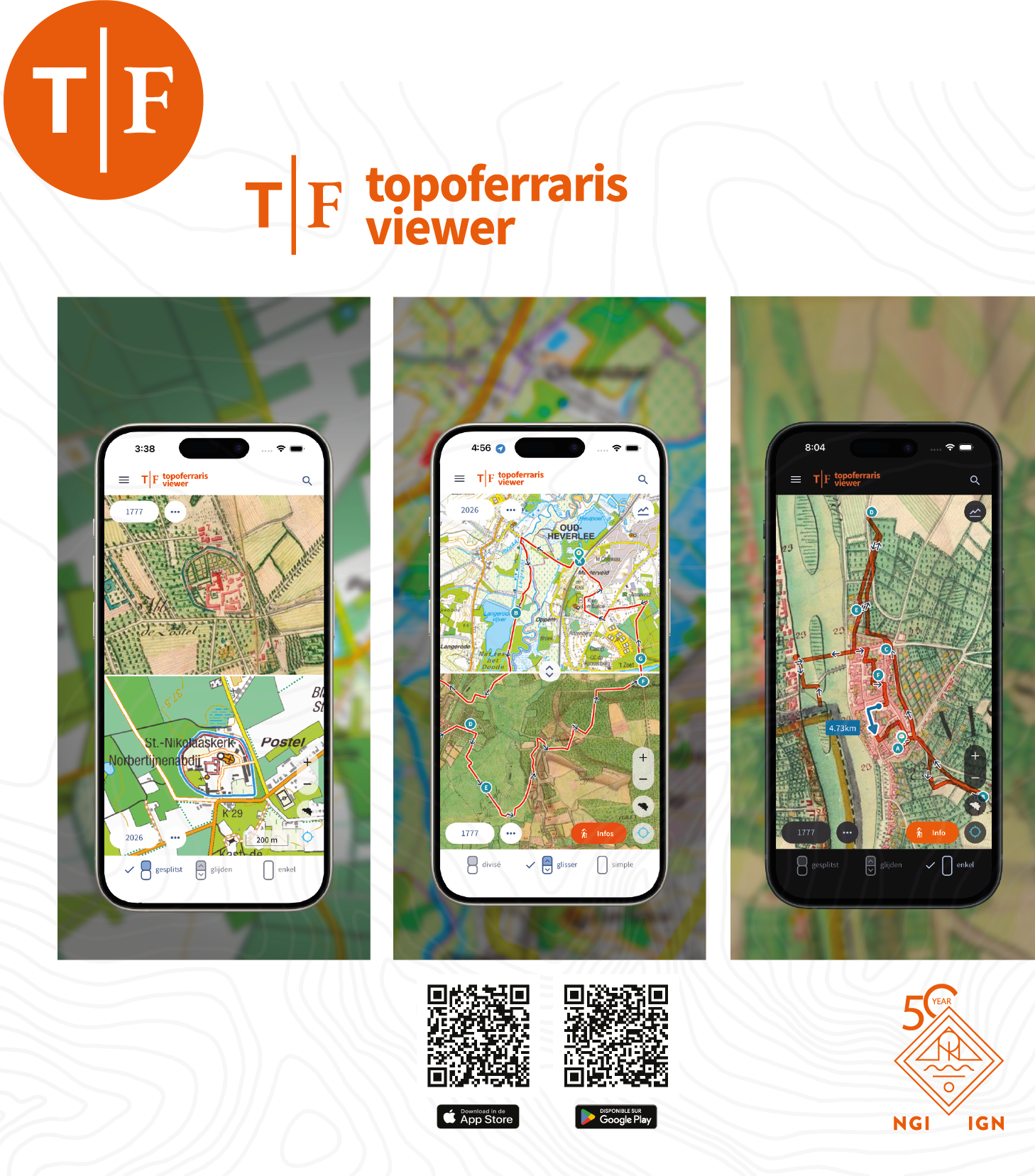 Topoferrarisviewer is also available as a mobile app on the Google Play Store and the App Store.
Users can follow suggested hiking routes or import their own GPX tracks to discover, on the ground, the remnants of the past that are still visible today, and gain a better understanding of how the landscapes they traverse have evolved.
The routes featured in Topoferrarisviewer are directly linked to the hiking guide ‘Op stap met historische kaarten van Ferraris’ (‘Exploring with Ferraris’ Historical Maps’), published by Lannoo on 16 June in collaboration with local historical societies.
Through twenty themed walks, the app and the book invite the public to explore the still-visible traces of the 18th-century landscape on the ground, offering a unique immersion in the history and evolution of Belgium.
A project linked to the publication of two new atlases
The launch of Topoferrarisviewer is also part of a broader project to highlight Belgium’s cartographic heritage.
To mark the 50th anniversary of the NGI, two new atlases were produced in collaboration with Lannoo and KBR:
These works, which are currently available for pre-order and will be published from 18 August 2026, were officially unveiled on 8 June during the NGI’s anniversary event. Read the press release.
Press Contact
Communications Service of the NGI: comcel@ngi.be.
Babs Carpentier (NL): 0478 52 86 70 and Sandrine D’Hoedt (FR): 0471 44 12 98
Press release on the NGI’s 50th anniversary. Website dedicated to the anniversary: ngi50ign.be