The great atlas by Ferraris – the first atlas of Belgium

alt=""
This atlas, comprising 275 hand-illustrated and coloured maps from Ferraris in 1777, immerses you in the historical landscape of the Austrian Netherlands and the Principality of Liege.

The Ferraris Map, realised under the direction of Count Joseph Jean François de Ferraris, is a map of the Austrian Netherlands and the Principality of Liege in 1777. This area largely corresponds to present-day Belgium, making the Ferraris map the first large-scale map of Belgium.

De Ferraris made two maps. The first was called the Carte de cabinet or Cabinet Map and was used exclusively by the cabinet and its ministers and generals. It was an extremely detailed and hand-drawn map on a scale of 1:11 520. The second map was the Carte marchande or Carte chorographique, which was less detailed and printed on a scale of 1:86 400. This particular map was intended for the general public and was created with the objective of recovering some of the costs of the mapping operation.

Three copies of the Cabinet Map were made: one for the emperor, one for the court chancellery in Vienna and one for Charles of Lorraine. The latter was returned to Belgium in 1922 as part of the post-war negotiations. Today, it resides in the Royal Library of Belgium. It served as the basis for the maps in this atlas.

alt=""

The Cabinet Map comprises 275 map sheets. Each map sheet was cut into pieces and glued onto yellow linen for practical handling. There are large and small sheets, and depending on the size (on average 45 x 141 cm and 90 x 141 cm), they are folded in two or in four. A fifth and sixth leaf or strip is sometimes added to the large maps.

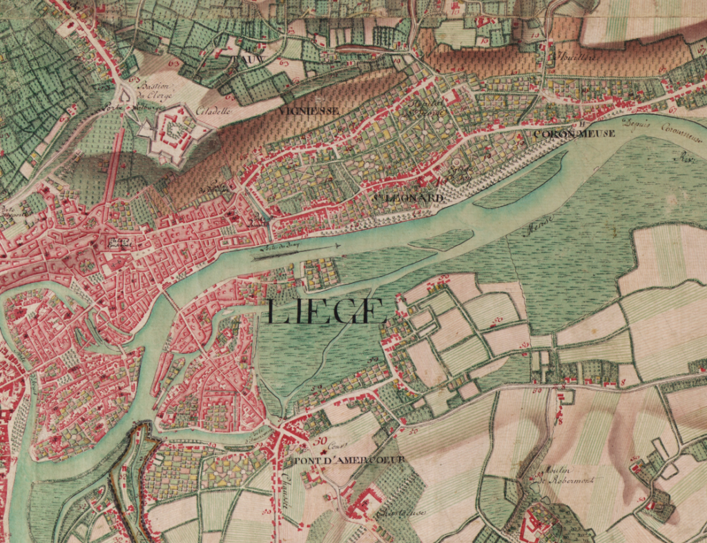
Through the use of various symbols and colours, the map sheets convey a wealth of topographical information, such as the various soil types, the road network, habitation, industries and borders. The relief is indicated by a reddish-brown hue representing inclines: the darker the colour, the steeper the incline.

The Cabinet Map is of inestimable historical value. It allows us to examine Belgium’s landscape prior to profound changes such as the French and Industrial Revolutions. The borders depicted also illustrate the complexity of the state structure with different counties, duchies and seigneuries. The rich diversity in place names also makes the map a wonderful resource for toponymy or the study of place names.

This work was carried out in close collaboration with the Royal Library of Belgium and Lannoo publishers. In this atlas, the map sheets from the Cabinet Map were scaled down to 1:24 000 to suit the book format. The reduced scale also allows us to start comparing the historical maps with contemporary maps in the 1:25 000 scale topographic atlas. Highly recommended for anyone who wants to observe the evolution of their hometown or other environments!

You can purchase this atlas on Lannoo’s website from 18 August 2026.